We recently spent a large part of the summer in Germany, starting off in the countryside not far...

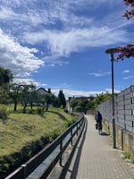
Harmony and I decided to go for a Sunday afternoon drive. I’m a little more inclined to plan our outings (maybe that’s something I need to work on) so I decided to have a quick browse of the local area on a map. West Kelowna is famed for its rugged terrain, picturesque views of Lake Okanagan and intense mountain climbs; so I wasn’t surprised when I came across a pin for Blue Hawk Mine.
History
The Blue Hawk Mine, a short-lived gold mine just outside Kelowna, BC, has a history of promise and abandonment. It opened in 1934, but only for a year. Despite producing some gold and silver, the mine was shut down. Throughout the 1960s and 80s, there were periods of renewed interest with exploration and drilling, but it never went back into full production. Today, the Blue Hawk Mine remains largely abandoned, a collection of tunnels and scars on the mountainside, a short chapter in the local mining story.
Directions
Getting to the mine is pretty straightforward - phone maps seem to have the location down pretty well. If you have access to a 4x4 with clearance, then it’s worth taking. Many say it’s essential but my 2009 front-wheel-drive Dodge Journey will disagree with them. The first half of the drive is on fairly smooth well-packed dirt and gravel, but the second half is over potholes and bumps as well as has three short, steep pitches to climb. Nothing intense, but worth knowing.
- Turn off Westside Road which runs parallel to the west side of Lake Okanagen, onto Bear Lake Main Road at the Trader’s Cove neighborhood. It’s a large well packed service road, so you won’t miss it.
- Follow Bear Lake Main Road for about 7 km and take a slight right off the main road, heading toward Bear Creek Recreation Site which is signposted.
- Around 550 m or so you’ll take the right turn, away from Bear Creek Recreation Site and continue uphill. The road becomes a little more rugged from that point on.
- Follow on for around 4.5 km, passing Jenny Lake on your right then taking the left fork.
- Note for Apple Maps: you may get directed down the right fork - this is incorrect, make sure to stay left and head uphill.
- Around 200 m or so after the fork you will see another small fork downhill to your right - this is not driveable so keep left and head up the steep section for another 50 m.
- You can park on the right on the grass.
To find the mine just head downhill on foot back toward the “undriveable” road/trail. Around 50m or so you will come to the cave entrance.
Safety
I had a good phone signal for nearly the whole drive after turning off the main road, including near the entrance to the mine. I would recommend, as with any adventure, to let someone know where you are and when you’ll be returning so they can alert services in case of an emergency and you can’t get help yourself. It may sound like an extreme measure but this is an abandoned, unmaintained mine shaft after all. Enter at your own peril!
Waterproof wellington/gumboots and a torch are a must.
Inside
The first thing you notice inside the mine is that the entrance will be flooded. Some good samaritans have loaded planks and pallets to help get across. Be very careful making the crossing, because everything moves and can be slippery. It’s only about 10 m before you’re on firm dry ground again.
The mine itself is really fun to explore. It’s absolutely pitch black in there so you will definitely need a light source, unless you’re significantly braver than I am. I won’t spoil the surprise of the directions, but don’t worry about getting lost because there are only two interactions and the “wrong turn” ends within sight of the last turn.
Enjoy the mine and don’t forget to check out the views of the lake too.
Jamie